Articles Menu
Clay and Katy Peck are just the type of young farming family that B.C. Agriculture Minister Norm Letnick says his government wants to support to ensure “a reliable food source for years to come.”
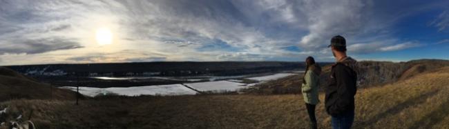
The Pecks own a 65-hectare farm in the Agricultural Land Reserve overlooking the Peace River, and are preparing for organic certification of a fruit and vegetable business to serve the northern area around Fort St. John.
The couple’s farm is high enough above the Peace River that it is not included in BC Hydro’s tally of 6,469 hectares of farmland — an area larger than all the farmland in Richmond — that will be destroyed by the Site C dam and its vast reservoir.
But the Pecks, along with other Peace Valley farmers, stand to lose significant amounts of farmland and crops to Site C in previously uncounted ways. The likely impact of Site C on agricultural land has been routinely underreported and will be far more dire than widely expected, according to scientists and information found in BC Hydro reports.
Work on the $8.8 billion dam project began in August and continues around the clock despite three on-going court cases by First Nations, missing federal government permits, and BC Hydro’s continuing failure to demonstrate the need for Site C electricity.
In addition to the agricultural land BC Hydro counts as permanently lost to Site C, another 5,900 hectares of farmland falls within what BC Hydro calls a “stability impact zone” and is at risk of destruction. BC Hydro insists a further 1,125 hectares of farmland — an area about the size of four Stanley Parks — will be lost only on a “temporary” basis during the next 10 years, but farmers and a soil scientist question whether topsoil on the land can ever be replaced.