Articles Menu
Nov. 14, 2022
This story is part of Going with the Flow, a series that dives into how restoring nature can help with B.C.’s flood problems — and what’s stopping us from doing it.
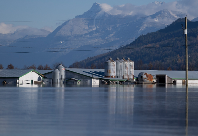
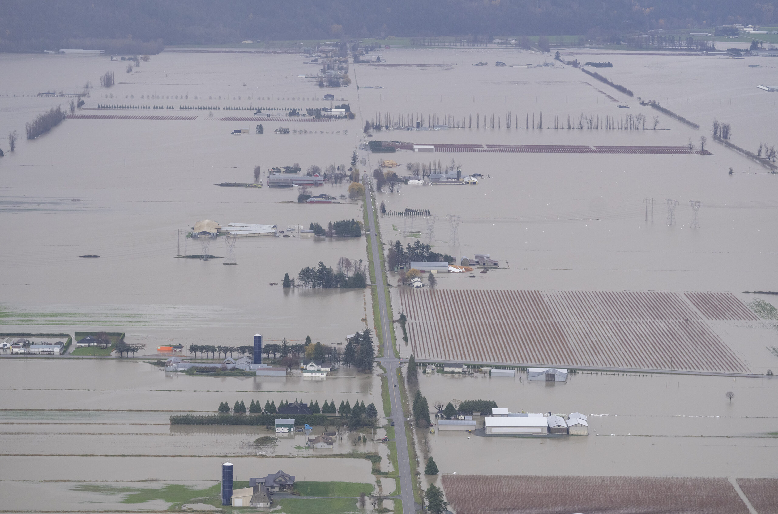
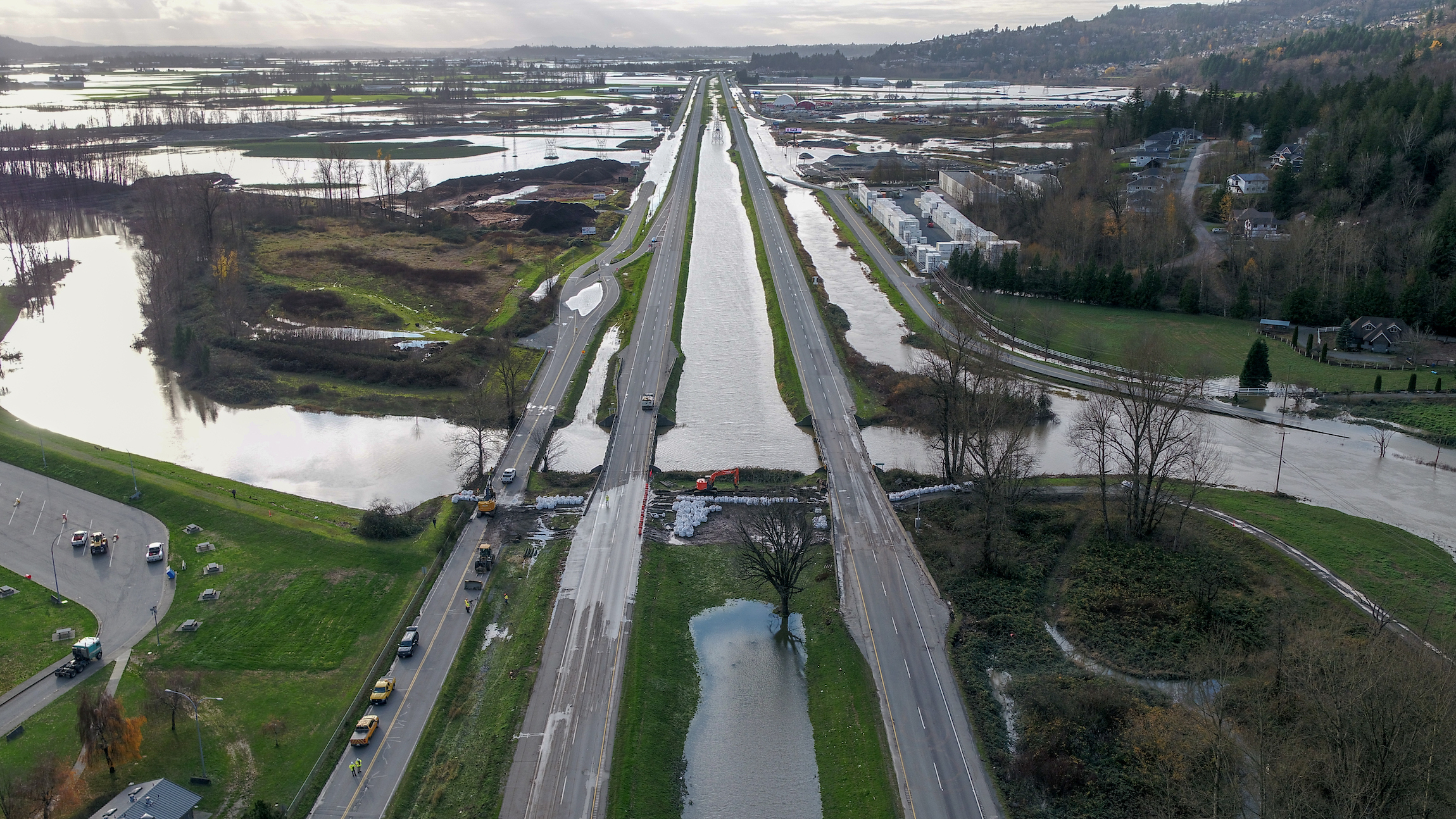
Heavy rains have once again fallen in B.C., bringing back memories of a year ago when an atmospheric river flooded the Fraser Valley. The storm destroyed infrastructure and killed five people, hundreds of thousands of chickens, thousands of pigs and hundreds of cows. It cost billions in damage and losses and blocked highways and a railway for weeks.
Since then, all levels of government, First Nations, other residents and agriculture and environmental groups have been hashing out how best to protect the area for the future, anticipating the next storm.
But the question of how exactly to “build back better” on land that was once water — especially as climate change makes extreme weather events more common — is exposing tensions about whether or not we should build back in certain areas at all.
“If this road was washed out, what’s the likelihood of that road washing out again?” asked Tyrone McNeil, Stó:lō Tribal Council Chief and chair of the First Nations Emergency Planning Secretariat. “Let’s relocate that road and put in a bridge instead of a culvert. That will actually save us money over time.”
McNeil is part of a growing chorus of people around the world who believe that returning space to water can help protect communities from climate change, including bigger floods and droughts. That’s because it’s not just climate change causing these disasters, but also development choices that have interfered with the natural water cycle.
Globally, 87 per cent of natural wetlands have been lost in the last 300 years, nearly all of them filled or drained by humans. People have intervened with dams and diversions on two-thirds of the world’s great rivers. Land area covered by cities, blocking water from sinking into the soil, has doubled just since 1992. To counteract this problem people are seeking to heal the water cycle by protecting and restoring wetlands, floodplains, mountain meadows and forests to help make communities more resilient.
But relocating people and infrastructure is emotionally and politically difficult, which is why so-called “managed retreat” — planning to move a community out of hazardous areas in an equitable, just way — often only happens after repeated disasters. Instead, solutions proposed tend toward doubling down on human-designed engineering that attempts to control water.
How many disasters will it take in the Fraser Valley? Climate change may soon force the issue, McNeil said.
“The Lower Mainland flood management strategy needs a hard reset,” McNeil said, referring to the plan that is primarily considering engineered interventions, such as raising dikes, dredging rivers and building more in flood-prone areas by raising the land first. “We need to be included in discussions as rights holders, not stakeholders. From there we put forward principles of salmon habitat, ecology, slowing the water, water storage.”
The province often seems more driven by election cycles, McNeil said. In contrast, his people make decisions based on caring for the next seven generations. “The dominant culture needs to have everybody’s interest [including other species] at heart on the table, not only those who are rich enough.”
Under the United Nations Declaration on the Rights of Indigenous Peoples, both the federal and provincial governments have pledged to incorporate Indigenous world views.
Federal Minister of Emergency Preparedness Bill Blair said Canada is being thoughtful about its approach to flood recovery.
“We’re looking at this whole idea of designing resilience into our build back to make sure that we invest in things that respect nature,” he said in an interview. “At the same time, we need to respond to what is clearly a changing and more volatile condition that we have to deal with: climate change.”
The total cost to rebuild the Fraser Valley will exceed $9 billion, according to Blair, the latest in a century-long engineering effort to hold back four big rivers and pump out water from a lake that’s routinely trying to reoccupy its space. But the typical pattern for such disasters, supported by current provincial programs, is to build back to “the pre-disaster condition,” with little funding for what are dubbed “preventative measures” or “enhancements.”
That was the case after a big flood in the region in 1948, said Tamsin Lyle, lead engineer with Ebbwater Consulting, which specializes in helping communities mitigate risks from climate change. During that earlier build back, “the mandate was not to reduce risk to public safety but to reestablish public faith in the diking system,” she said.
Today, on the federal level, up to 15 per cent of disaster funding is earmarked for “mitigation” — but that’s not yet defined, according to Lyle. “It might be an opportunity to make your dike a little bit higher, but there’s no mechanism to say, ‘Hey, what if we didn’t have a dike at all?’ ”
McNeil and Lyle are part of the Build Back Better, Together Collaborative, an Indigenous-led working group that came together after the storm to help with flood recovery. The collaborative issued a press release last week to increase pressure on the provincial government to use what’s left of the billions of dollars of federal funding announced in December to support “best practices,” especially nature-based solutions. This would align with the federal and provincial governments’ commitments to the international Sendai Framework for Disaster Risk Reduction. The framework outlines disasters as opportunities to rethink standard practices, noted the release.
The dominant culture’s mindset toward flooding needs to change, Lyle said, citing a 2014 paper in which international experts laid out the golden rules for flood management. Number one is accepting it’s impossible to prevent all flooding. Number two is to promote some flooding as desirable. That’s because, if people don’t give water enough space, it will take it by force. So it’s better to plan ahead where people can best tolerate it.
“It’s not just climate change causing these disasters,” Lyle said, but also “stupid human decisions. We’re on the cusp of that recognition in Canada: that big engineering has failed us.”
Perhaps the November 2021 flood will be a catalyst. To some extent, the province is supporting what are known as nature-based solutions, according to an email from a spokesperson for Emergency Management B.C., which did not make someone available for an interview.
The spokesperson pointed to the B.C. Flood Strategy, open for public comment this fall, and “modernization” of its emergency management legislation, set for spring 2023, which strives to manage risk, rather than prevent disasters, and to co-develop the strategy with Indigenous Peoples under the principles of the United Nations Declaration on the Rights of Indigenous Peoples.
In B.C.’s 2022 budget, the province allocated $2.1 billion “to help people recover from the devastating floods and wildfires of last year and to better protect communities against future climate disasters,” according to a news release. Provincial programs, including $81.8 million for Green Infrastructure: Adaptation, Resilience and Disaster Mitigation and $110 million in budget 2022 for the province’s Community Emergency Preparedness Fund, could support nature-based solutions — but the money could also go toward engineered infrastructure.
“The flood gave a lot of people the idea that we need to work together,” Semá:th Chief Dalton Silver said. “I was able to present our position on a lot of things.” But both Silver and McNeil believe more is needed.
“The extent of the consultations are not where they should be,” Silver said.
McNeil added that the more settler governments open themselves up to Indigenous perspectives, the more they would benefit. “We’re actually alleviating risk for government by seeing our values reflected,” he said.
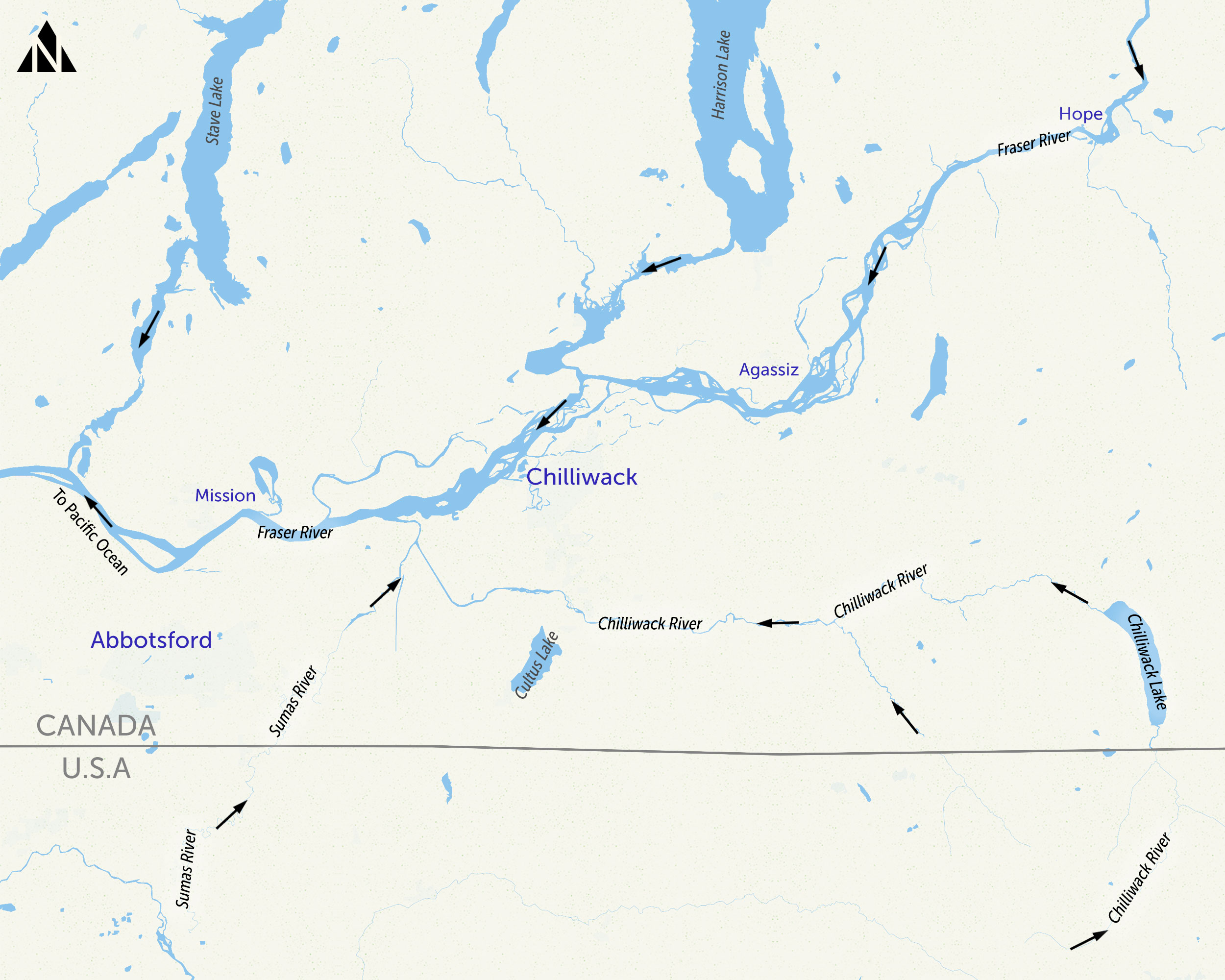
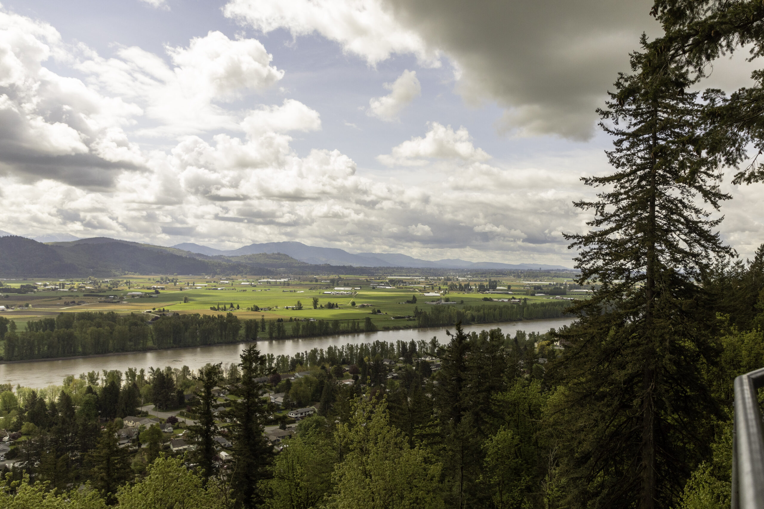
At the heart of the debate around restoring space for water to prevent future flooding is Semá:th X̱ó:tsa (Sumas Lake).
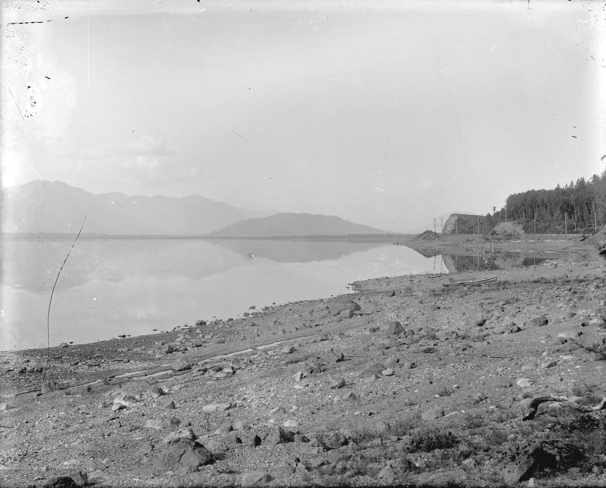
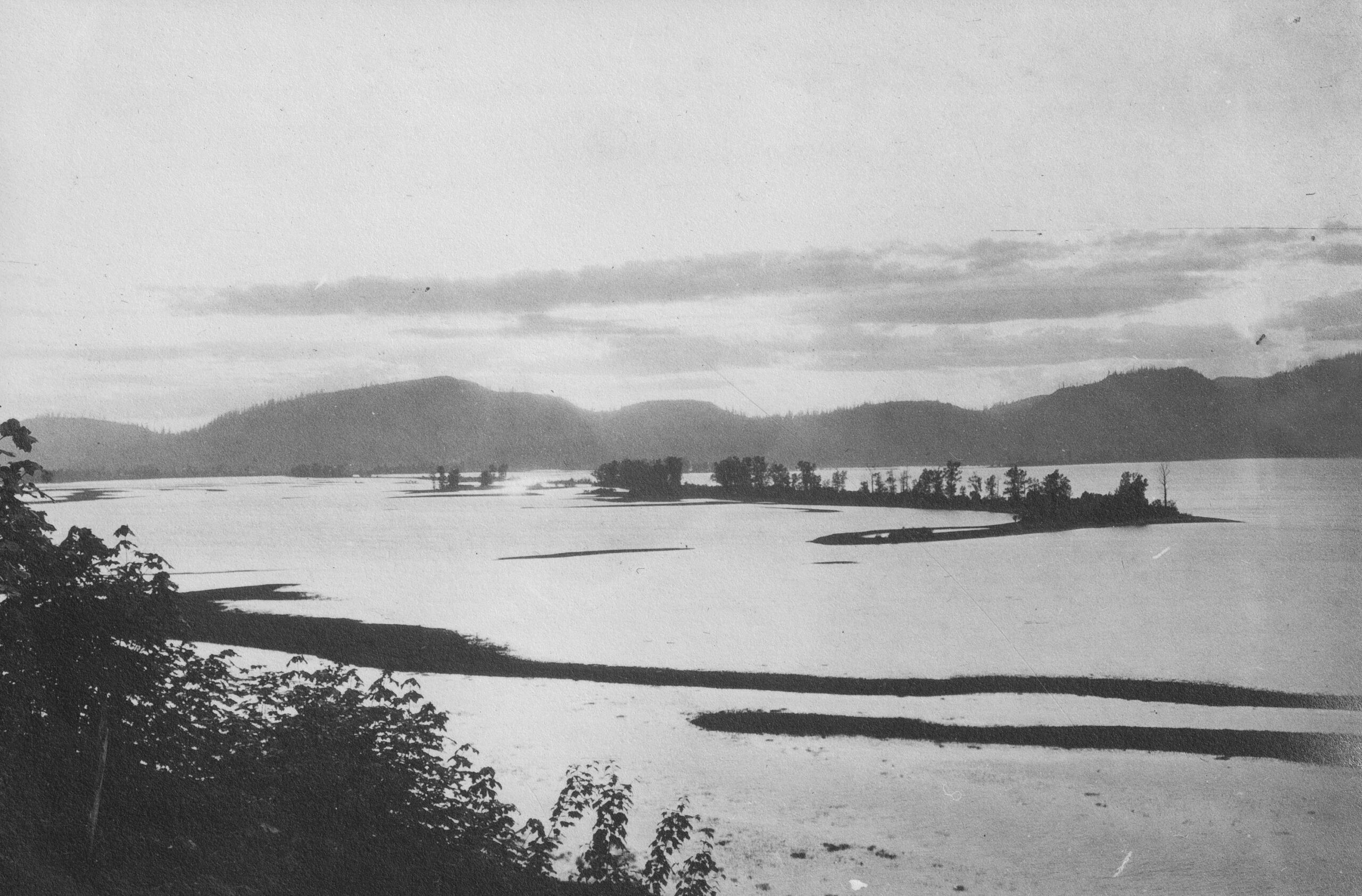
A hundred years ago, Semá:th X̱ó:tsa lay between the current cities of Abbotsford and Chilliwack and stretched across the border into Whatcom County, Wash. It pulsed like a heartbeat, ebbing and expanding with the fall rains and freshet, or spring floods. It regularly went from 36 square kilometres to 65, frequently expanding far more in flood years, according to Chad Reimer, author of Before We Lost the Lake: A Natural and Human History of Sumas Valley. For the Semá:th (Sumas First Nation) and other bands in the Stó:lō Nation, the lake “was the provider for our people,” Silver said, extolling the bounty of sturgeon, salmon, mussels, trout, ducks and deer. The sturgeon also provided a strong, organic glue called eisenglass that was a major trade item.
Bands of the Stó:lō Nation accepted water’s agency and worked within its rhythms. “We moved before the freshet,” McNeil said.
Silver explained they built no permanent structures on the wetlands surrounding the lake, and seasonal movements were intrinsic in their teachings.
“My grandfather said the Stó:lō — which means river or water — is regarded as the great giver of life, but you need to be careful when you’re out there, travelling or harvesting fish,” Silver said. “Water is also a very powerful entity that can take your life as well.”
But settlers saw the lake as blocking them from perfectly good farmland, according to Reimer. “The view of the western world is very much a binary one,” Reimer said in an interview. “Stuff is either land or water. And where you have water on top of good land, you’ve got to get rid of that water.”
Over a 50-year period, settlers endeavoured to turn water to land, eventually succeeding, more or less, in 1924. According to Reimer, it took 142 kilometres of dikes, canals and diversion ditches; floodgates to prevent river overflows into the lakebed; and a pump station. They optimistically redubbed the place Sumas Prairie and filled the former lake with homes and farms.
In November 2021, “nothing surprised me about where the water wanted to go,” Reimer said. “The natural hydraulic conditions that created Sumas Lake are still there. We’re just holding it back.”
Despite ongoing concerns about flooding, the City of Abbotsford is not considering bringing back the lake or much in the way of nature-based solutions, according to an overview of its preferred option for long-term flood mitigation.
“I’m not sure how you would do that in Sumas Prairie, with all of the infrastructure that runs through there, including Highway 1, railways, pipelines transmission and hydro transmission lines,” Abbotsford Mayor Henry Braun said.
Lyle told The Narwhal the city seems to be taking a “build back bigger” rather than a “build back better” approach. “Abbotsford wants dikes up in 10 months,” she said.
The trouble with Abbotsford’s plan is “they haven’t considered the fragility of that system,” Lyle said, despite having just seen it fail. The Barrowtown pump station, which keeps the lakebed dry, was saved only because hundreds of people rushed to build sandbag walls around it through the night. If it had failed, water would have sat in the lakebed for months. “They’re not taking a risk lens to it,” Lyle said. “They just assume that engineers can get this right.”
Dikes present a bit of a “catch-22,” Lyle explained. “The more you squish up the dikes, the faster and higher the water flows and the more likely the dike is to fail.”
The city’s plan is to build bigger dikes, with a few small setbacks to allow a little more space for water, and an additional pumping station, the latter of which would cost $800 million, according to Braun.
“I’m responsible under the community charter to protect infrastructure and residents,” he said.
Lyle said she appreciates his motivation. “Mayor Braun has really got his community at heart and feels like he’s protecting his community, but he’s just doing it — in my very biased opinion — totally wrong.”
Tara Martin, a forestry professor at University of British Columbia, Semá:th Councillor Murray Ned and their colleagues question whether building more infrastructure to hold back water is the best environmental, socially just and financial decision.
Together, they are working on a peer-reviewed paper, calculating that buying out landowners and moving homes and business to higher ground to allow Semá:th X̱ó:tsa to reflood would cost about $3 billion, compared with $4.5 billion to maintain the status quo through 2050. Beyond that, ongoing costs are more uncertain. Restoring the lake would also be a start toward righting colonial wrongs, the authors wrote in a Globe and Mail op-ed, and help save 70 species currently at risk of extinction.
Minister Blair acknowledged that it “may not be the right thing to rebuild” everywhere. But that principle seemingly doesn’t extend to Sumas Prairie. “I don’t think anyone is talking about returning the lake,” he said. “We’re always interested in the economic case. But it’s also about community and the activities they’re involved in,” he added, citing the area’s agricultural importance to the province and country.
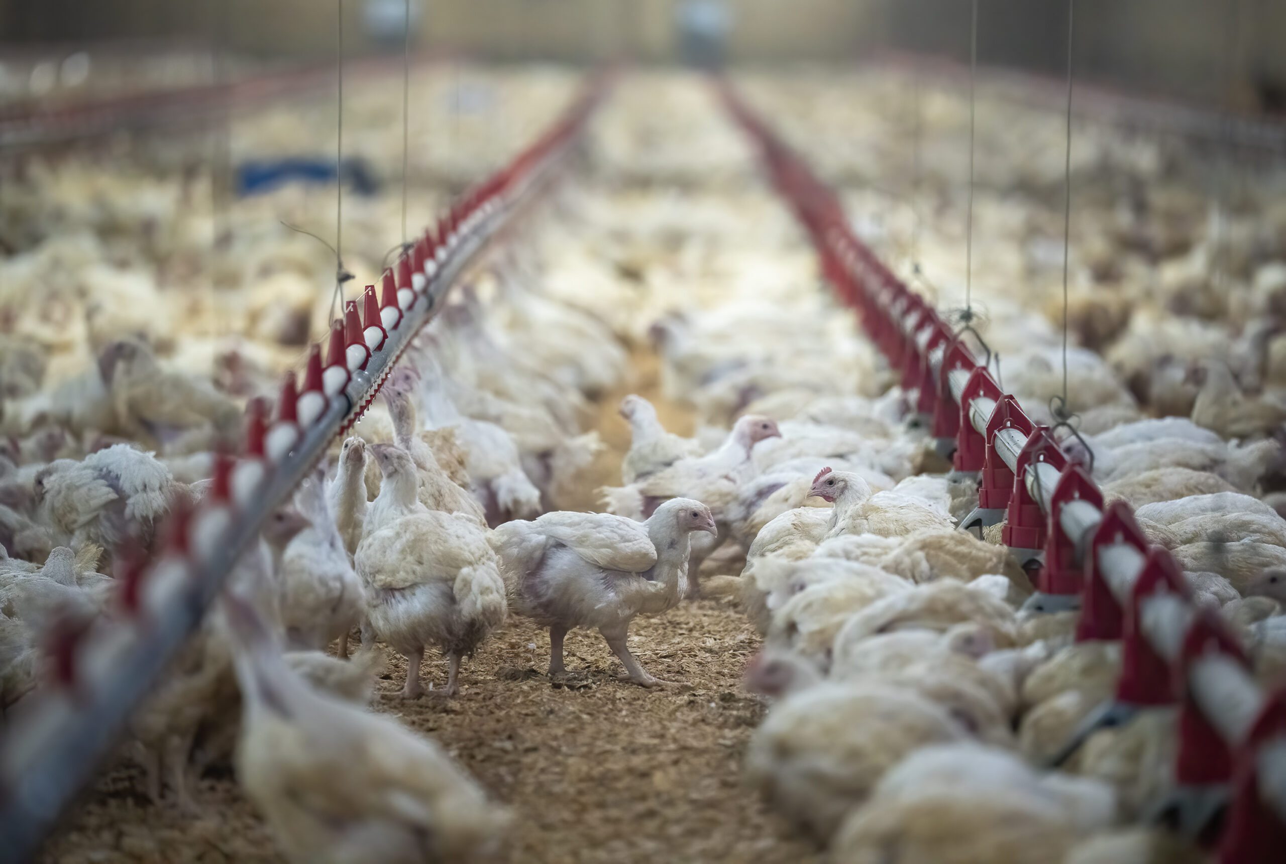
Braun makes that argument too. “Fifty per cent of our dairy, poultry, eggs, turkeys, whatever it is, that’s consumed in British Columbia comes from Abbotsford,” he said. “We can do without a lot of things: food and water are not one of them.”
Reimer, who grew up in the area, is frustrated at the “unquestioned premise” that British Columbia must get its cheese, milk and eggs from the floodplains of the Fraser Valley. “That sounds completely logical, but it isn’t,” he said. “Nowadays, chickens and cows don’t see the light of day,” noting the barns they live in could be elsewhere.
Holger Schwichtenberg, chair of the B.C. Dairy Association, acknowledges that most cows today do spend most of their lives in barns and could conceivably be raised elsewhere. But getting to that point requires answering many questions that most people are not yet contemplating.
He listed some of them: “Where would you go? How would you get the milk to market? How would landowners be compensated?” With supply chain disruptions becoming more common, “being able to supply local food is a big deal,” he said.
Reimer acknowledged that truth and said one option would be to move livestock but continue growing some current foods, like berries, which would be lower value to lose in a future flood. But with floods becoming more frequent and severe, he said it’s time to start asking those difficult questions that Schwichtenberg raised.
“It was depressingly fast how everyone was thinking, we’ll just build bigger pumps,” Reimer said.
Both Silver and McNeil are circumspect when talking about the prospect of the lake’s return. If governments were to buy up land from settlers and return the lake or parts of it, “it would go a long ways to helping with wildlife and fish habitat,” Silver said. “And some of our people would be satisfied with that.” At the same time, he said he doesn’t want to see relatives and friends, including settlers, displaced.
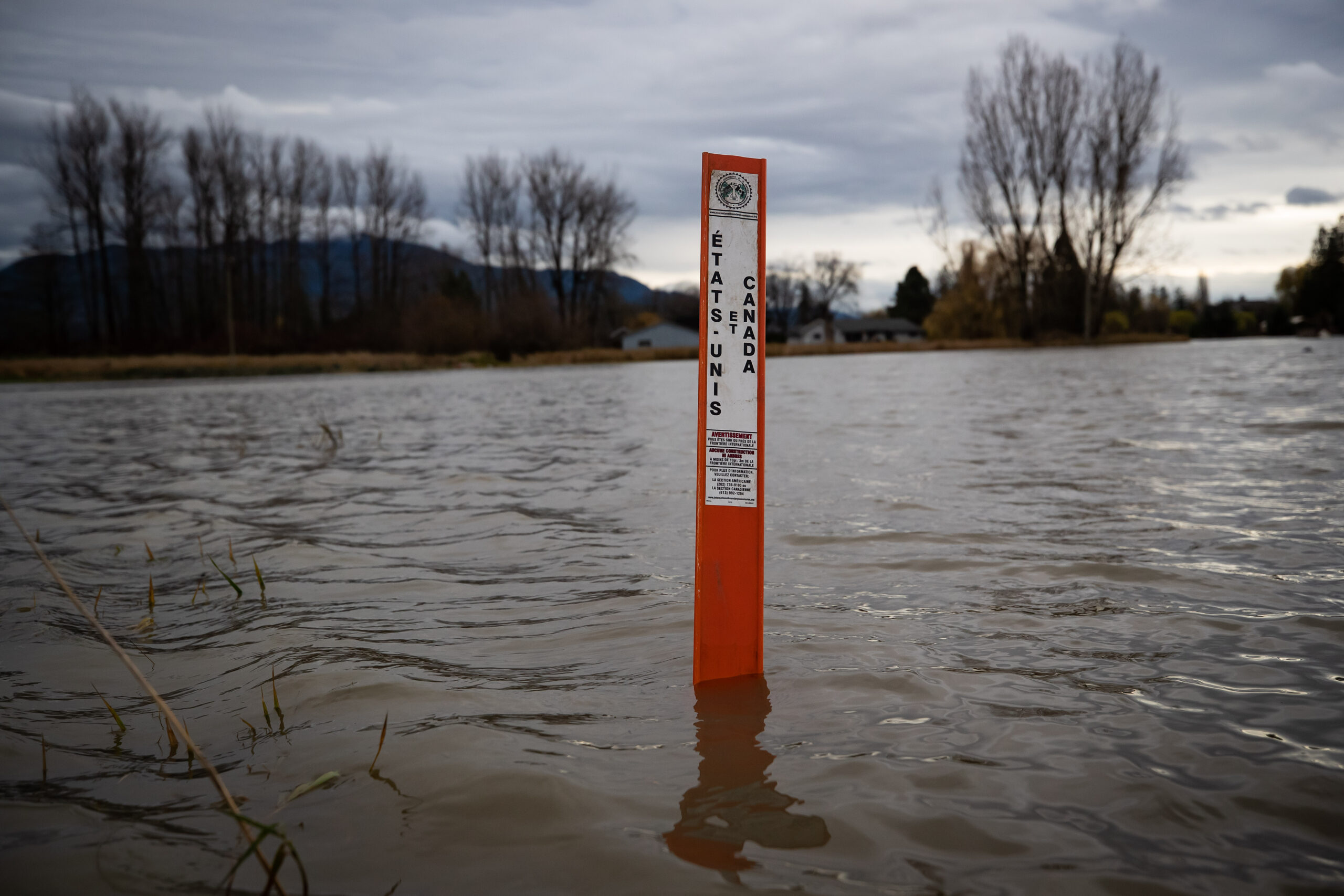
A significant contributor to the November 2021 flooding came from the Nooksack River, which originates in Washington and once flowed to Semá:th X̱ó:tsa. Centuries ago, it deposited sediment which created a natural levee at Everson, Wash., turning the river left. But in November 2021, unusually high flows overtopped this natural barrier and the Nooksack once again flowed straight downhill into Abbotsford.
Some Canadians are a little testy about that and would like Americans to hold back the water. But the last big flood on this system, in 1990, spurred Washington to take a different path, asking hard questions as a first step to changing how and where people can restore natural systems.
Its Floodplain Integrated Planning process makes space for water, reducing flood risk, restoring habitat for salmon and boosting climate resilience for agriculture and people. The planning team includes government staff, flood control and watershed improvement districts, tribes and people like Paula Harris, Whatcom County’s river and flood engineering manager.
“We’ve developed a lot of trust over the last few years that we’re in this together and trying to get to the same end goal,” Harris said. “There’s gotta be a lot of winners. And ideally no losers. Or if they do lose, they’re compensated for their loss.”
Abbotsford Mayor Braun said, with some incredulity, that he just recently learned that Washington decided more than two decades ago not to build a dike at Everson, instead accepting the overflow path the river has chosen. The water has to go somewhere, Harris said. “When you start diverting water from one flow path into another, you own the increased damages in that other flow. It’s hard to make a conscious decision to flood other people worse.”
Elsewhere, along other tributaries that flow into British Columbia, Washington has already set back some levees where houses were washed away in the past, giving rivers more access to their floodplains. Designers placed logjams strategically in the floodplain to deflect water’s energy away from levees. During the November 2021 floods, those projects worked as intended, protecting people from flooding, Harris said.
McNeil said he is impressed by Washington’s efforts. “They opened up the waterways, got the support of farmers and local governments. And since they modified the land base to store water, three out of the last five years, they reached [396 cubic metres per second] and nobody’s even noticed,” he said.
Cross-border talks have been underway, most notably between B.C.’s premier and Washington’s governor, but also among many others in various sectors and levels of government.
The instinct to build a wall in response to a threat is deeply ingrained in the dominant culture. “The Euro-centric view is that human values are priority,” McNeil said, “that development is the number one priority, generation of wealth.” Prioritizing human needs as more important than animals or water and its systems leads to single-focus problem solving. Need water? Build a dam and collect it from elsewhere. Concerned about flooding? Build a wall to keep the water out.
That viewpoint is diametrically opposed to that of the Semá:th, Silver said. “From our perspective, you’re supposed to respect that waterway and everyone else that lives there [including nonhuman beings] as much as you respect one another.”
“There’s a lot of disrespect for everything out there that we see with the newcomers to our lands,” Silver said. “People fighting with water all the time … the very taking of the lake … was one of our very early environmental disasters.”
Blair said he’s listening. “I heard very clearly from [First Nations] the importance of incorporating Indigenous Traditional Knowledge into our response. And one of the things they did say to us is how important wetlands are to flood mitigation.”
McNeil said the Stó:lō Nation is ready to lead, but they need buy-in from like-minded allies. To that end, he’s asking another set of hard questions: “How do we come together for our collective long-term aspirations that speak to resilience, that speak to promoting salmon and a broader ecological footprint here in the valley, rebuilding a lot of what was here before development started?”
Updated on Nov. 14, 2022, 9:56 p.m. PT: This story was updated to correct the spelling of X̱ó:tsa
Updated on Nov. 17, 2022, 3:08 p.m. PT: A previous version of this story stated that the Fraser River flows from Jasper National Park. The story has been updated to clarify the Fraser River flows from headwaters in Mount Robson Provincial Park, near Jasper National Park.
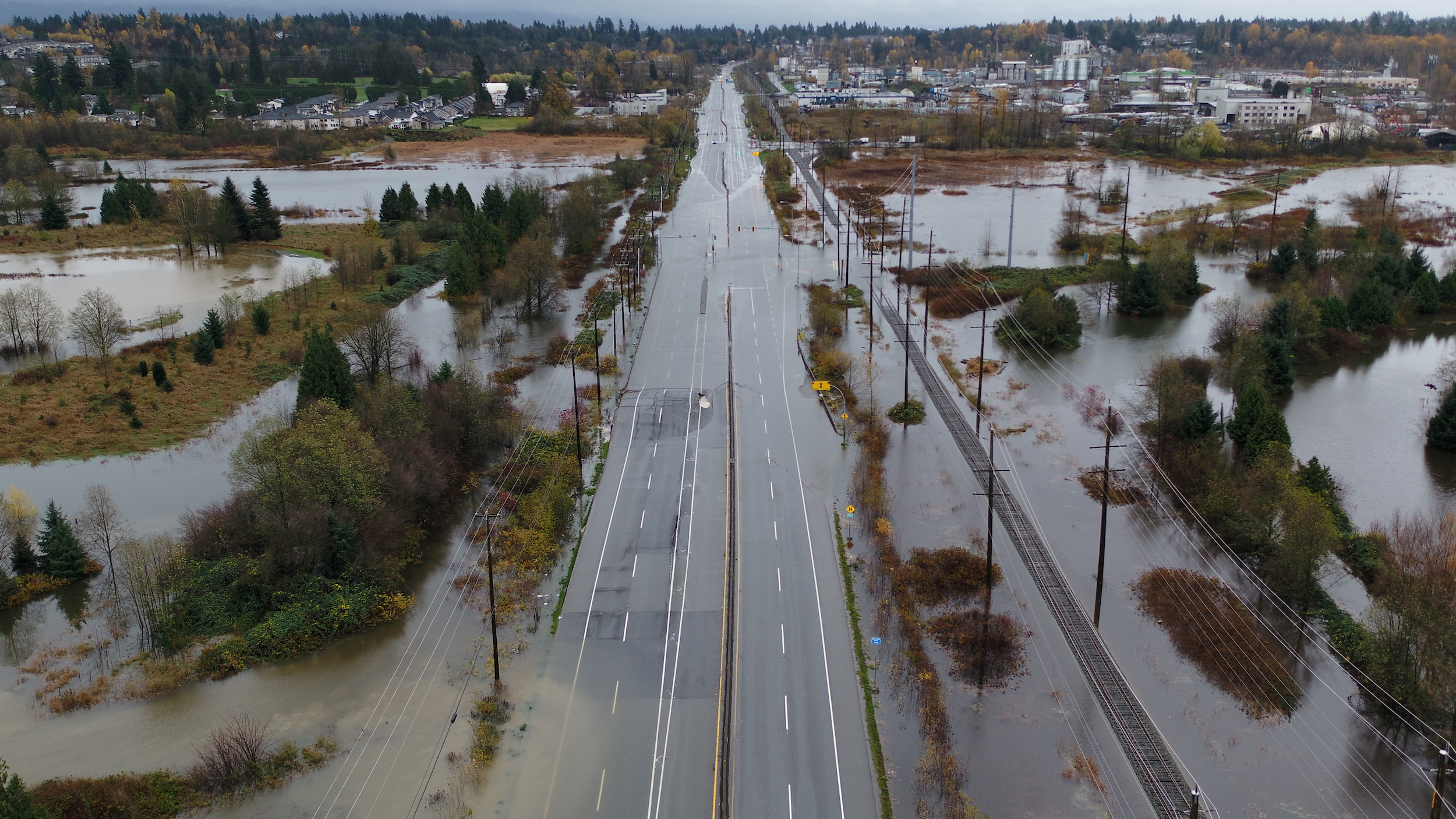
[Top photo: A catastrophic atmospheric river caused extensive flooding in B.C.’s Sumas Prairie in November 2021. As governments allocate billions of dollars for rebuilding, experts are proposing more funds be spent on nature-based solutions informed by Traditional Knowledge. Photo: Jonathan Hayward / The Canadian Press]